By: Briana Gallagher, Flood Management Division.
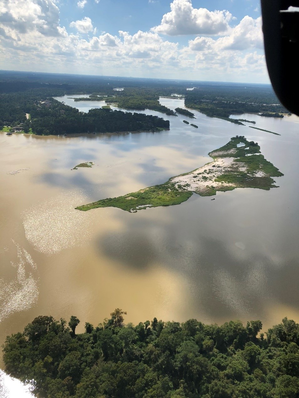
It’s almost been two years since Hurricane Harvey hit Texas. It was not only the worst storm experienced by Texans, but the worst storm recorded in U.S. history. Hurricane Harvey effected many things, one in particular is it physically changed our rivers and their ability to safely pass flows due to the tremendous amounts of silt deposited. The United States Army Corps of Engineers is spending over $70 million for a contractor to dredge more than 1.8 million cubic yards of sediment deposited at the mouth of the West Fork of the San Jacinto River near Lake Houston during Hurricane Harvey.

Sand Bar in the West Fork of the San Jacinto River near Lake Houston.
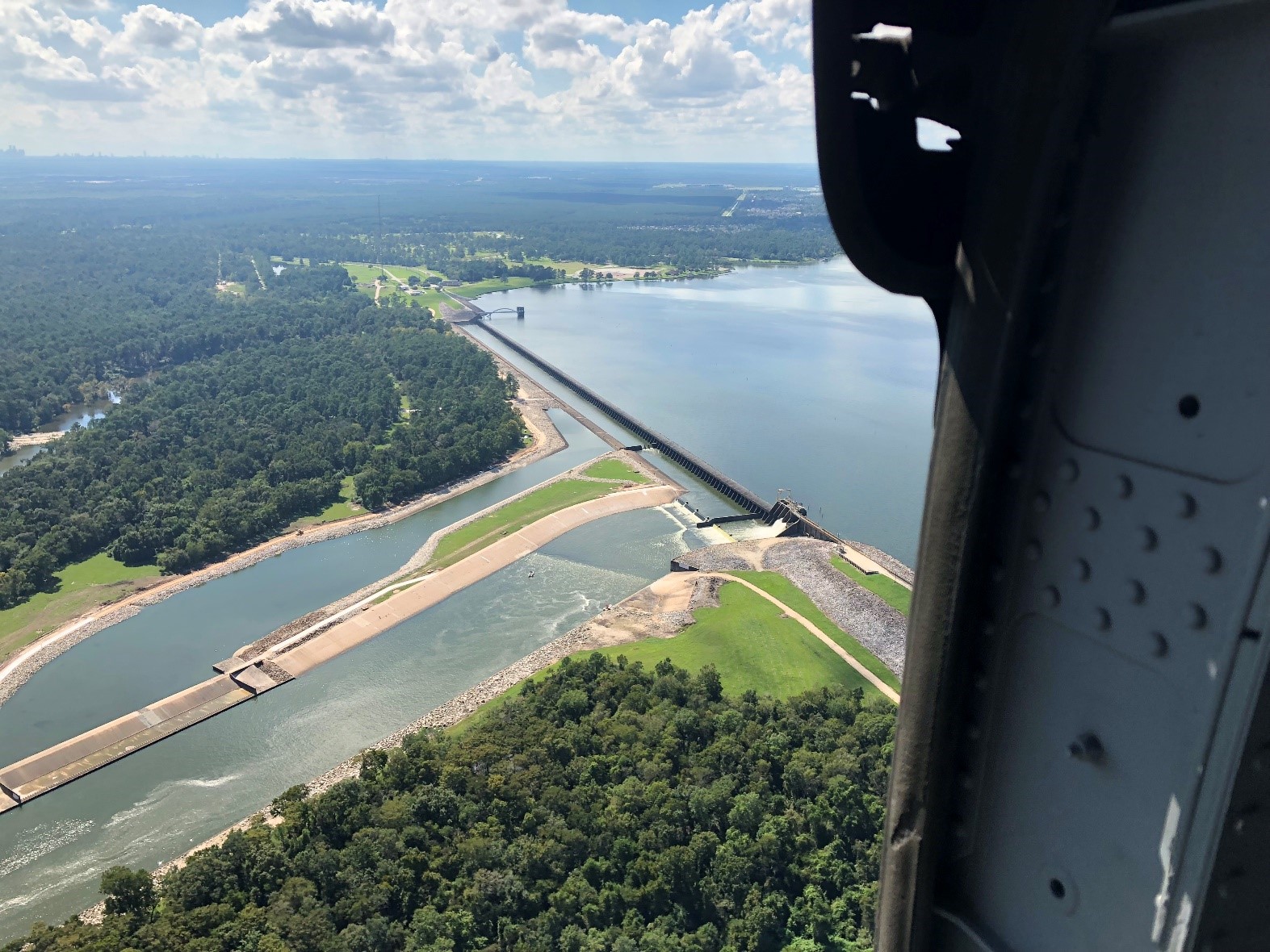
The emergency dredging is just one short-term solution to help address flooding in communities in Northeast Harris County. However, other long-term structural flood mitigation strategies are needed to provide these communities relief and reduce the risk of flooding during future storm events. Long-term solutions that have been mentioned to date include additional tainter gates on Lake Houston and regional detention on one or more of the eight major rivers or creeks that feed Lake Houston.

Spillway and gate at the Lake Houston Dam
For Lake Conroe, SJRA will conduct the temporary seasonal lake lowering in the spring and fall seasons as these two seasons are typically when the greatest amounts of rainfall enter into the West Fork San Jacinto River watershed above Lake Conroe. As a reminder, the normal pool elevation for Lake Conroe is 201ft above mean sea level (msl). The temporary seasonal lowering will begin on April 1st with SJRA gradually reducing the lake to an elevation of 200 ft-msl. SJRA will begin recapturing flows on June 1st. In the fall, SJRA will gradually reduce the lake level beginning on August 1st to achieve a lake level of 200 ft-msl by August 15th and continue reducing the lake until it reaches an elevation of 199 ft-msl. SJRA will then begin recapturing flows on October 1st. One thing to note: if a significant storm enters the forecast while releases are being made to lower the lake level, releases will be discontinued and the river will be allowed to drain out until there is no longer any rainfall in the forecast.
So, how does this temporary seasonal lowering compare to typical lake levels? The graph below shows the average lake levels for each month from 1997 through 2017. As you can see, it is not uncommon for the lake to be well below 200 ft-msl in the month of August.

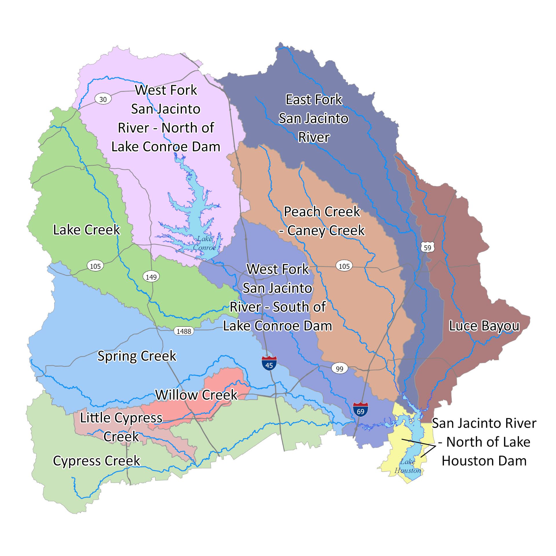
Upper San Jacinto River Watershed Map
Another short-term strategy being implemented by SJRA and the City of Houston is a joint coordinated operations strategy for Lake Conroe and Lake Houston. Under this temporary strategy, SJRA will temporarily lower Lake Conroe in the spring and fall through February 2020. The strategy for Lake Houston is different, given that Lake Houston is close to the Gulf of Mexico and does not have any reservoirs downstream impounding drinking water supplies. The Coastal Water Authority, which is the agency that operates Lake Houston for the City, will lower Lake Houston to 41.5 feet from its normal elevation of 42.5 feet whenever the basin is expected to get more than three inches of rain.

The seasonal lake lowering of Lake Conroe is a temporary strategy that the SJRA Board of Directors will review and revisit in February 2020.
For additional information on SJRA or the Flood Management Division, visit our website at www.sjra.net or follow us on Facebook @SanJacintoRiverAuthority and Twitter @SJRA_1937.

Featured in May, 2019 Issue of Dock Line Magazine.

